Researchers Correlate Stream Modification to Sediment Movement in Houston Area During Hurricane Harvey
Enormous amounts of sediment, or sand and mud, flowed through Houston waterways during Hurricane Harvey in 2017, due in part to modifications made by humans to bayous, rivers and streams over the past century, that could seriously impact future flooding events and be costly to the City of Houston.
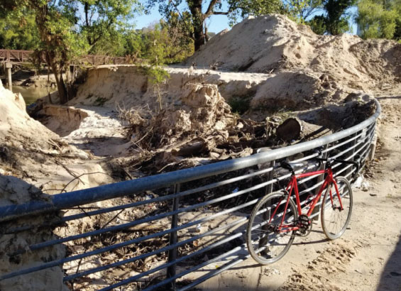
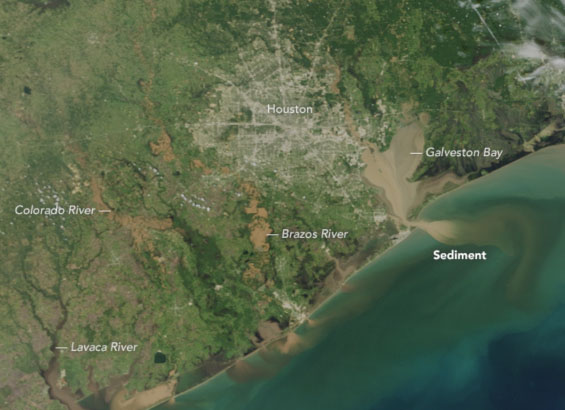
New analysis by geology researchers at the University of Houston found 27 million cubic meters of sediment, or 16 Astrodomes, moved through 12 Houston waterways and Addicks and Barker reservoirs during Harvey, the largest rainfall event in U.S. history. After the storm, up to five feet of sediment accumulated in the Houston Ship Channel, costing $350 million to dredge it back to its pre-Harvey depth. From August 25 to 31 of 2017, the study found, the amount of sediment moved through Houston was equivalent to about 40% of the sediment discharged annually to the Gulf of Mexico by the Mississippi River.
“We found a strong correlation between stream modification and sediment bypass through those streams,” said Andrew Stearns, first and corresponding author of the study, published in the journal “Geology.” He conducted much of the work while earning his master’s degree in the laboratory of Julia Wellner, a contributing author and associate professor of geology at UH’s College of Natural Sciences and Mathematics.
River straightening, a type of artificial stream modification, is an engineering technique used to shorten the distance to the ocean and increase water flow, which reduces flooding in surrounding areas. Straightening can be as minor as removing bank vegetation or as extreme as replacing the banks and channel floor with concrete. The technique was used on Houston’s waterways in the 1940s and ‘50s and opened development areas for additional homes and buildings. However, as the study authors found, an unintended consequence is more sediment moves downstream as well.
“Our study provides policymakers with vital information for sediment management in urban watersheds. Not much attention has been given to sediment management, but it has big implications for the city itself, and can be quite costly when omitted from a watershed plan,” added Stearns.
He and the researchers report sediment deposits during Harvey decreased holding capacities in Addicks and Barker reservoirs by about 1.2% and 1.6% respectively.
“If Harvey were to happen again today, there would be less room for water in Addicks and Barker reservoirs because of the sediment that got left behind from Harvey,” Wellner said. “That’s the significance – sediment takes up space no longer available for water.”
Stearns uses Lake Houston as an example. A large sand bar recently emerged from the water where the west fork of the San Jacinto River enters the lake near Kingwood. The U.S. Army Corps of Engineers has dredged the top of the bar several times in recent years. “If you have this big mound of sediment blocking water flow to the lake, there’s less area for the water to go,” he said. “During floods, the water goes around that bar of sediment, and into somebody’s house.”
The research team used lidar, or light detection and ranging, a remote sensing technology that measures the elevation of the ground surface, to reach their conclusions, in addition to some ground observations. Lidar allowed them to determine the elevation change from pre-storm to post-storm due to sediment movement.
Causes of Massive Sediment Movement
Stearns said there was so much sediment in the waterways due to compounding factors of the deluge of rain and human modifications to the surrounding environment.
“We found 75% of Houston received over three feet of rain in five days,” he said. “When you get nearly your annual rainfall in such a short amount of time, that’s going to move large amounts of sediment quickly.”
Whether humans created or contributed to more sediment, Stearns and Wellner say it is likely. Because urban sprawl has covered prairie and natural green spaces with impermeable concrete, more water flows into drains and eventually to surrounding bayous. And with more developed land, erosion rates are higher as well, which contributes to the sediment.
“With more rainfall, more run off and more erosion, you are moving more sediment moving through bayous and rivers,” Stearns said.
Information for Policymakers on a Budding Research Topic
The team hopes their study leads researchers and policymakers to collect data on regional sediment movement on a regular basis, not only because of how costly it is to dredge sediment out of waterways, as seen in the ship channel, but also because of the potential impact it can have on flooding in the Houston area. Additionally, they want policymakers to see the impact river straightening can have on sediment movement.
“This study is just the beginning for understanding sediment movement through urban environments,” said Stearns. "With current technology, we were only able to see above-water, but there’s a lot of opportunity to look at underwater sediment movement as well.”
Shuhab Khan, professor of geology at UH, and Jerome Kendall of the University of New Mexico are contributing authors of the study.
- Rebeca Hawley, University Media Relations